

Traveler Mountain Overlooking Mt. Katahdin
After Katahdin and a few other jaunts in the southern portion of Baxter St. Park, I embarked on the second leg of my trip. Situated in the northern section, the destination was South Branch Pond and the famed Traveler Loop. The 11.1 mile Traveler circuit bags four peaks: Peak of the Ridges, Traveler, Little Traveler, and North Traveler. Together, they form a picturesque backdrop to the views of North and South Branch Ponds from the campground. Once on the loop, the hiker is exposed to a constantly changing landscape, vegetation, rocks, and vistas that overlook the woods and waters of northern Maine. It is a stunning hike that surpasses Mt. Katahdin in terms of difficulty and beauty.
The main road connecting the southern and northern sections was washed out so I had to leave and drive around in order to enter the northern gate. This took a better part of my morning. Before I entered the northern sector, I made sure to check out the weather forecast and it did not look good. A large rain storm was approaching that was estimated to bring several inches of rain, lightning, and high winds.

I made sure to have a long chat with the park ranger at my campground who basically told me not to do the loop. With 80% of the hike exposed and lightning forecasted with the storm, I began to doubt my own ambitions. He also warned of the slippery nature of the volcanic rocks, easily eroded trails, and loose scree. I realized that he was legally required to tell me not to go, so I asked him what he would do, if he was in my shoes. He avoided the question but told me that the hike could be completed in six hours, if you were really good. Over a beer, a paddle, and a view of the lake, I decided to go for it by waking up super early and trying to beat the approaching storm. When I told the ranger about my plans, he wished me luck and simply told me, "there would be no rescue".

I woke up super early to pack up my camp (thats a long story), gear up, and hit the trail at first light. I made sure to bring extra supplies, a shelter, clothes, and food incase I was forced to abandon the hike and spend the night on the trail. It had rained through most of the night, and the first half mile along Pogy Notch Trail saturated my pants and "waterproof" boots. The mosquitos were extra thick, even for Baxter, and remained a constant nuisance for the entire day.


Scattering some baby loons...

It rained off an on as I ascended North Branch Pond via the Center Ridge Trail.


The Center Ridge Trail ascends up to the Peak of the Ridges. It features steep climbs, winding switchbacks, and stellar views of the lakes below. On this particular day, I made the ascent through the fog, which severely limited any vista.


There are multiple false summits as one makes their way to the top of Peak of the Ridges. They provide a welcomed respite from the seemingly endless climb. As I made my way through the fog, I was able to rest my legs and give my lungs a breather.


Looking down onto North and South Branch Ponds.

Looking across the ravine to the descent after North Traveler Mtn.

Little Traveler on the right and North Traveler on the left.

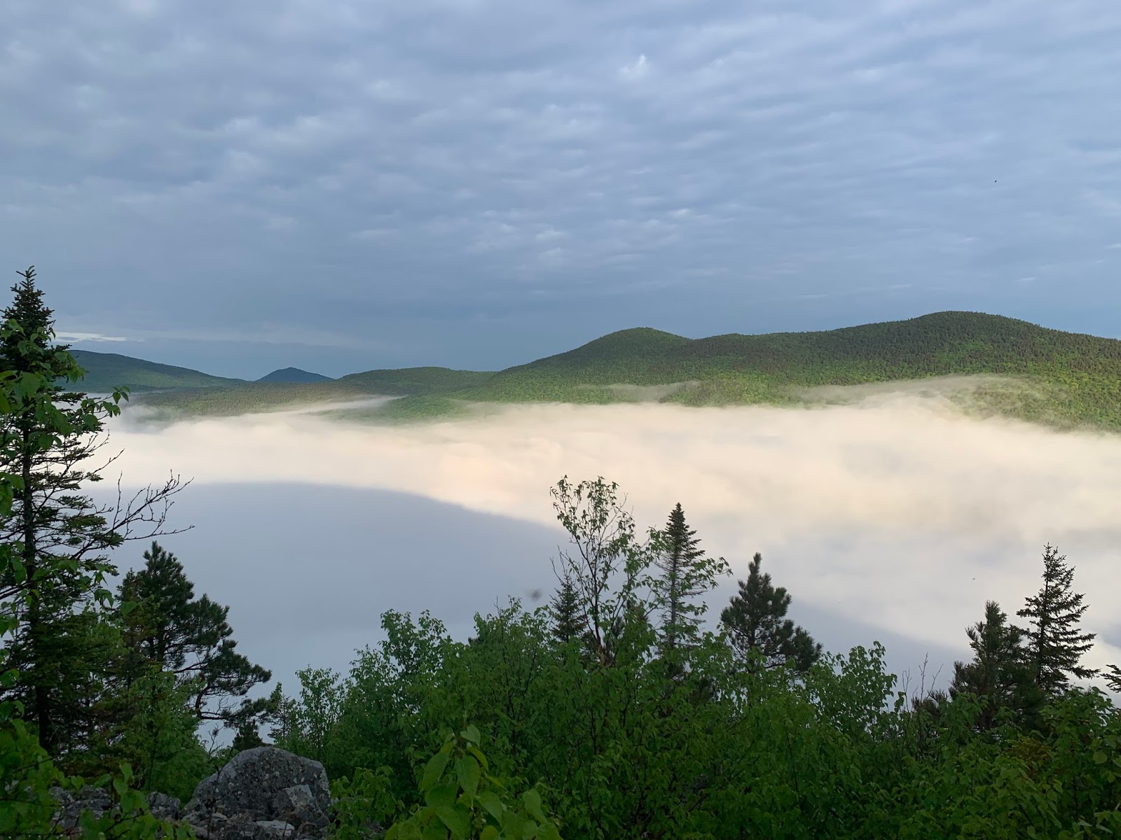
The top of Peak of the Ridges previewed the spectacular views that I would experience throughout the entirety of the hike. Although covered in fog, the scene was unique, and I was fortunate to have any view at all with the approaching storm.


Mt. Katahdin from Peak of the Ridges

An ocean of white...

Looking back down the trail and the last false summit.

Looking ahead to the next summit on Traveler Mtn. After Peak of the Ridges, there is a mini "Knifes Edge" before descending into a thick coniferous forest with a bed of balsam fir. Moose scat abounded in this forest and I eagerly anticipated turning a corner to reveal a bull moose. Unfortunately, that never happened.

Another shot of North and Little Traveler Mtns.

Looking back on the summit of Peak of the Ridges, the mini "Knifes Edge," and a sketchy traverse across loose scree. Briefly, the fog seemed to lift revealing the forest below. However, this was short lived...

Rock cairns guided the way across the talus.


The top of Traveler Mtn, provided a 360 degree view of Baxter St. Park and Mt. Katahdin. I took a long break here to soak in the scene and reflect on the path to this point. I even got cell phone reception to check the approaching storm, send a few texts, and "do it for the gram".


A view of the real Knife's Edge and the traverse I made two days prior...

Am I still on the East Coast?

The storm was quickly approaching and I still had more than halfway to go. The descent from Traveler was slippery due to smooth features of the rhyolite volcanic rock that abounded around the summit. It began to rain off and on again but the main event was still two hours way...

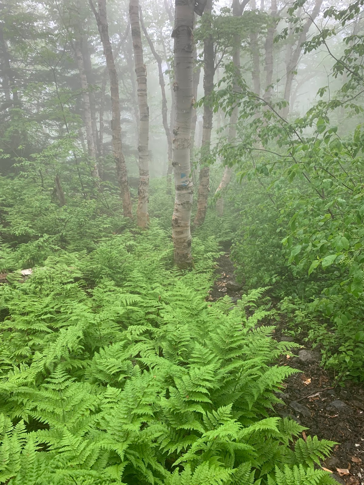
Off the summit, one enters another forest with an entirely different character on the other side of the ridge. A variety of moss, ferns, and other plants abounded. I felt more like I was in the Pacific Northwest than in northern Maine. I had a close call on this trail. I was descending a steep portion when I slipped on a root. I stopped my fall on a larger boulder that promptly came loose and tumbled down the trail. It missed my legs by inches.


Ascending Little Traveler Mtn.

A rock cairn showing the path to Traveler Mtn.

The summit of Little Traveler looking up to North Traveler Mtn.

Traveler Mtn. on the left and Peak of the Ridges on the right.

After summiting Little Traveler Mountain, I began to pick up my pace. The storm was approaching and I wanted to be on the descent once it came. Every now and then I would stop to take in the views. The above scene looked like something out of Game of Thrones. The wall of mist was moving up Little Traveler Mtn. like the approaching White Walkers.


Getting farther away from the first two summits...

The top of North Traveler.

After summiting North Traveler, I got out my rain gear in anticipation for what was about to go down. The mosquitos and no see ums seemed to encircle me as a warning sign of the dropping barometric pressure. It wasn't long before the clouds moved in, the skies opened up, and it began to pour...

One of the last pictures I took as I began the long descent on the North Ridge. This portion of the trail featured alpine meadows, long downhills switchbacks along cliffs, and finally back into a deciduous forest. The descent was made in the sea of fog and there were several times that I lost track of the blue blaze. The trail became saturated and filled with water, which made things a little more challenging going downhill. The descent seemed to take a lot longer than it actually was. I was cold, wet, tired, and alone.

I finished the hike before noon and spent the rest of the day under a pop up tent with my only companions being a jet boil, some coffee, a warm fire, and a lot of bugs. The campground was desolate, just like my hike. It took a few months and several washings for the smell of campfire to fade out of the clothes I wore on this long day. Every time I smelled that smoke, it reminded me of my circuit hike on the Traveler's Loop. As of right now, it is the favorite hike I have ever done. I highly recommend it to anyone traveling north to Maine looking for some adventure.

No comments:
Post a Comment